×

Trail running

Trailrunning in alpiner Höhe
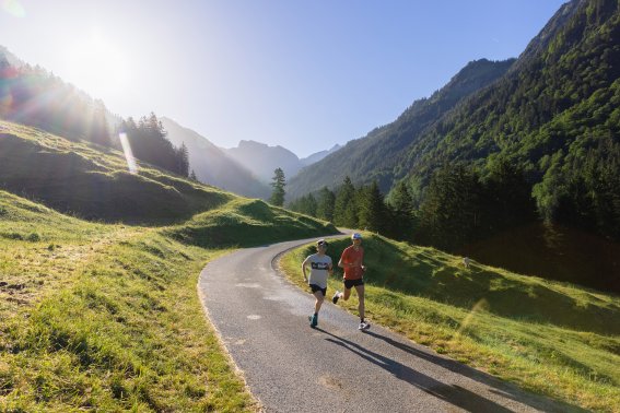
Check out the varied trails around Oberstdorf and experience the spectacular natural landscape of the Allgäu Alps.

With three altitude levels and varied routes, Oberstdorf is ideal for trail runners of all standards: beginners,
intermediates and professionals alike will all find the perfect places to run.

Beginner suggestions (easy)
Hohenadl circular trail

Beginner suggestion (easy) 

Length: approx. 8 km
Elevation gain/loss:
approx. 138 m

This beautiful trail heads past the Moorweiher lake towards the Trettachtal valley. 

Route description:
Nebelhornbahn cable car valley station - Mühlenbrücke bridge - Trail to the Jägerstand café - Dr.- Hohenadl-Weg trail - Oytal valley road - (optional loop around the ski jumping arena) - Oberstdorf

Tip: it’s not essential to carry drinks on this short route. If you need some refreshment, the Jägerstand café is a great place for a break.

Trailrunning im Oytal
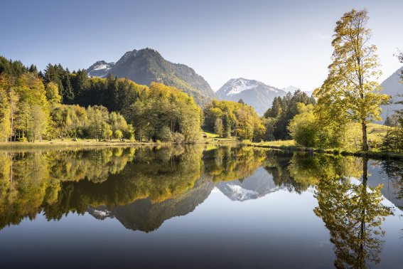
Moorweiher lake

Beginner suggestion (easy) 

Length: approx. 6.8 km
Elevation gain: approx. 78 m

This beautiful trail heads past the Moorweiher lake towards the Trettachtal valley.

Route description:
Mühlenbrücke bridge - Moorweiher lake - Oberstdorf golf course - Grubenweg - Oberstdorf

Tip: this route is also ideal for running groups as it sticks to wide trails and paths.

Herbst am Moorweiher
Reichenbach circular route

Beginner suggestion (easy) 

Length: approx. 8.9 km
Elevation gain/loss:
approx. 133 m

Setting off from by the Dummelsmoosbrücke bridge, follow the wide gravel track along the Trettach and Iller rivers to the Oberstdorf district of Rubi. The technically simple but sharply ascending Bergöschweg trail begins just after the chapel. After a short but sharp downhill section and a number of meadow paths, you will reach Reichenbach. From here, a broad, gently undulating trail leads back towards Oberstdorf and your starting point on Am Dummelsmoos.

Route description:
Dummelsmoosbrücke bridge – Trettachdamm trail – source of the Iller – Rubi/Bergöschweg trail – Reichenbach – Rubi – Oberstdorf

Tip: the route can be optionally extended to the Schöllang mountain church.

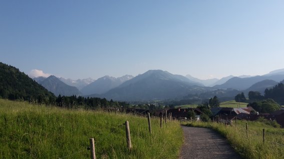
Blick nach Oberstdorf
Auwaldsee lake circular route

Beginner suggestion (easy) 

Length: approx. 9.5 km
Elevation gain/loss: approx. 123 m

Along the Iller to the neighbouring municipality of Fischen. The route starts and ends at the car park on Karweidach.

Route description:
Karweidach car park – source of the Iller – Rubisteg (bridge) – Fischen Au – Auwaldsee lake – detour to the Schöllang mountain church – Bergöschweg trail – Rubi – Rubisteg (bridge) – Waldweg trail – Karweidach car park

Tip: if you like, you can run a few extra laps of the Auwaldsee lake. Each lap is about 1,500 metres.

Auwaldsee
Freibergsee lake circular route

Beginner suggestion (easy) 

Length: approx. 10.7 km
Elevation gain/loss: approx. 282 m

Route description:

Renksteg – Freibergsee lake – Edmund-Probst-Weg trail – Waldesruhe – Stillachdamm trail – Renksteg

Starting from the Renksteg, climb to the Freibergsee lake and run 3/4 of the way round this in an anticlockwise direction. Continue slightly uphill along the well-developed Edmund-Probst-Weg trail to the Bergkristall restaurant from where you head back down into the valley. Finally, follow the Stillachdamm trail all the way back to where you started at the Renksteg.

Tip: the Freibergsee lake is the highest bathing lake in Germany – and a great place to cool off on hot summer days!

Freibergsee
Suggestions for intermediate runners (medium)
Wallrafweg

Suggestion for intermediate runners (medium) 

Length: approx. 12 km
Elevation gain/loss: approx. 382 m

A panoramic route above Oberstdorf with views of the Illertal valley.

Route description:
Ice sports centre - Faltenbachbrücke bridge - Ski jumping arena - Breitenberg - Wallrafweg - Gaisalpe - Gaisalptobel ravine - Reichenbach - Riedweg - Rubi - Kalkofenweg - Dummelsmoos - Ice sports centre

Tip: if the final downhill section through the Gaisalptobel ravine is too demanding, you can also follow the road for a gentler descent.

Der Wallrafweg
Geißberg

Suggestion for intermediate runners (medium) 

Length: approx. 6.7 km
Elevation gain/loss:
approx. 560 m

Route to Tiefenbach’s local mountain for intermediate-level runners.

Route description: Tiefenbach (Tourist Information Office) - Lochwiesen - Geißberg - Hintere Falkenberg Alpe (shelter) - Vordere Falkenberg Alpe (shelter) – Lochwiesen - Tiefenbach (Tourist Information Office)

Tip: you can also follow this circular route in the opposite direction. Take care to pace yourself on the steep climb and don’t forget your your smartphone or camera for that summit selfie.

Trailrunning-Workshop
Gerstruben trail

Suggestion for intermediate runners (medium) 

Length: approx. 15 km
Elevation gain/loss: approx. 402 m (ascent and descent)

Route description:

Oberstdorf Mühlenbrücke bridge – Moorweiher – golf course – Christlessee lake – Gottenried – towards Spielmannsau – Rautweg trail – Gerstruben – Hölltobel ravine – Oberstdorf

A challenging circular trail route that runs past the Moorweiher to the Christlessee lake, towards Spielmannsau and then along the Rautweg trail to Gerstruben (1,143 m) in the Dietersbachtal valley. From there, it takes a short but sharp downhill through the Hölltobel ravine back into the Trettachtal valley and on back towards Oberstdorf.

Important!
This route includes 400 altitude metres of both climb and descent and the trails are extremely challenging.

Trailrunning
Hochleite trail

Suggestion for intermediate runners (medium) 

Length: approx. 11 km
Elevation gain/loss:
approx. 446 m (ascent and descent)

Route description:
South edge of Oberstdorf – Öschwiesenweg trail – Renksteg – Freibergsee lake – Schwand – Hochleite – Freibergsee lake – Ziegelbachhütte – Stillachdamm trail – Oberstdorf

This trail starts with a leisurely stretch along the meadow path to the south of Oberstdorf. From the Renksteg, it then heads steeply uphill to the scenically located Freibergsee lake and on to the hamlet of Schwand. From there, it zigzags its way up to the highest point on the route, the Hochleite. Finally, the sharp downhill section leads you into the Stillachtal valley and across forest and meadow trails back to Oberstdorf.

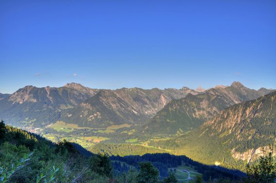
Allgäuer Bergwelt
Jägersberg trail

Suggestion for intermediate runners (medium) 

Length: approx. 7.7 km
Elevation gain/loss: approx. 281 m

Route description:

Karweidach - Illerursprung - Langenwang - Jägersberg - Judenkirche - Wasach - Weidach (bus stop)

This route takes runners along a wide variety of terrain, from a wide, gravel path to a narrow single trail. Passing the source of the Iller, the route leads to the village of Langenwang (Fischen). From here, you enter the undulating terrain of the Jägersberg and the Ochsenkopf, constantly accompanied by the spectacular views of Oberstdorf and the mountain scenery. Passing the Judenkirche and the hamlet of Wasach, you eventually head down to your destination, the bus stop in Weidach.

Tip: stop for a break at the Judenkirche viewpoint and gaze through the impressive rock gate for a magnificent view of Oberstdorf and its mountains.

Jägersberg
Suggestions for advanced runners (challenging)
Schnippenkopf - Sonnenkopf

Suggestion for advanced runners (challenging)

Length: approx. 21 km
Elevation gain/loss:
approx. 600 m

Route description: Nebelhornbahn cable car valley station - World Cup Ski Jump Arena - Wallrafweg trail - Gaisalpe restaurant - Falkensattel saddle - Falkenalpe shelter - Schnippenkopf - Heidelbeerkopf - Sonnenkopf - Schöllang - Reichenbach - Rubi - Nebelhornbahn valley station

Tip: always check the weather forecast if planning to run this route. You’ll find the latest information in the daily mountain sport report from Tourismus Oberstdorf.

In Richtung Tal
Hahnenkopf

Suggestion for advanced runners (challenging)

Length: approx. 16 km
Elevation gain/loss: approx. 900 m

A summit experience with far-reaching views and the crossing of a ridge.

Route description:
Mühlenbrücke bridge - Trettachtal valley - Dr.-Hohenadl-Weg trail - Oytalhaus - untere Lugenalpe - obere Lugenalpe - Hahnenkopf - Gerstruben - Hölltobel ravine - Trettachtal valley - Mühlenbrücke bridge

Tip: it’s well worth taking a compact camera or your smartphone with you to capture lasting memories of the impressive Oberstdorf mountain world.

Weg zwischen Lugenalpe & Hahnenköpfle
Besler trail

Suggestion for advanced runners (challenging)

Length: approx. 17 km
Elevation gain/loss:
approx. 883 m

Route description:
Tiefenbach (Tourist Information Office) – Lochwiesen – Vordere Falken Alpe – Hintere Falken Alpe – Schwaben Alpe – Besler – Mittlere Gund Alpe – Schwaben Alpe – Lochbachtal valley – Lochwiesen – Tiefenbach (Tourist Information Office)

A route that is largely characterised by its length and the number of altitude metres it covers – and that should not be underestimated. This is also a relatively technical route for runners. It involves demanding stretches on challenging trails and tough climbs that are sure to get your heart rate up. At the end of the route, the tarmacked Alpine road down into the valley is ideal for picking up the pace and stretching out the legs. The route begins at the Tourist Information Office in the Oberstdorf district of Tiefenbach.

Ausblick vom Besler
Rubihorn trail

Suggestion for advanced runners (challenging)

Length: approx. 15 km
Elevation gain/loss: approx. 1257 m

This route is one of the classics in the Oberstdorf mountain world but demands a great deal of trail runners in terms of both technique and endurance. The trail crosses the Faltenbachtobel ravine, the Seealpe and the Roßbichl, heading uphill all the way. From the Niedereck, the partially exposed ridge trail to the Rubihorn summit begins. Permanent safety features are provided in certain areas. Make sure you hold on tightly! The initially steep downhill in part takes the form of a demanding single trail and winds its way past the Gaisalpsee lake and the Untere Richteralpe to the wide, gravel Wallrafweg trail, which takes you back to Oberstdorf.

Route description:
Ice sports centre – Faltenbachbrücke bridge – Seealpe (Nebelhornbahn middle station) – Roßbichl – Niedereck – Rubihorn – Unterer Gaisalpsee lake – Gaisalpe – Wallrafweg trail – Oberstdorf

Please note
Always check the current weather forecast before starting this route. Old and new snow fields are common in the higher sections at certain times of year.

Weg zum Rubihorn
Laufbacher Eck trail

Suggestion for advanced runners (challenging)

Length: approx. 21.8 km
Elevation gain/loss:
approx. 1,635 m

Route description:
Mühlenbrücke bridge – Trettachtal valley – Dr.-Hohenadl-Weg trail – Oytal valley – Käseralpe – Wildenfeld – Himmeleck – Laufbacher Eck – Zeigersattel – Nebelhornbahn Höfatsblick mountain station

This route requires excellent technique and fitness and is only suitable for highly experienced trail runners who are well-versed in the use of trail running equipment. Offering fantastic panoramic views, the trail runs into the Oytal valley, past the Käseralpe and up into high Alpine terrain. Continue past the Wildenfeld to the Himmeleck and on to the Laufbacher-Eck. The continually undulating route then passes the Seealpsee lake and over the Zeigersattel to the Nebelhornbahn’s Höfatsblick mountain station.

Tip: with stunning views and spectacular flora, the ridgeway along the 2,000-metre border is among the most beautiful the Allgäu Alps have to offer.

Useful info: in the sections after the Laufbacher-Eck in particular, you will regularly find iron steps and passages protected by cables. Make sure you slow your pace and focus on where you are going here.
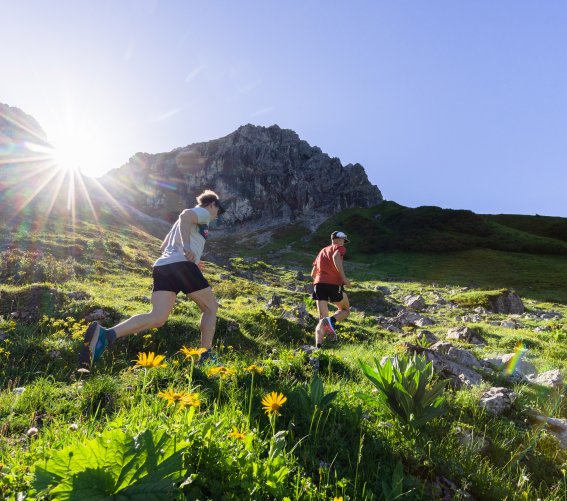
Vorbei an den Wildenfeldhütten
Söllereck-Fellhorn trail

Suggestion for advanced runners (challenging)

Length: approx. 8.6 km
Elevation gain/loss: approx. 1,089 m

The route leads from the Söllereckbahn valley station to the mountain station, passing the Sölleralpe. It then continues along the Fellhorngrat ridge, heading south along the German-Austrian border to the summit of the Fellhorn. The altitude difference is mainly ascending, always demanding and extremely varied. The ridge trail to the Fellhorn summit offers pure bliss for seasoned mountain runners, rewarding them with perfect mountain views. The descent occurs in the comfort of the Fellhornbahn cable car.

Route description:
Söllereckbahn valley station – Söllereck mountain station – Sölleralpe – Fellhorngrat ridge – Fellhorn summit

Tip: anyone who wants a more relaxed start to this route can complete the first climb in the comfort of the Söllereckbahn cable car, saving their energy for the demanding single trail towards the Fellhorn.

Bergtour am Fellhorngrat

Oberstdorf athlete Jojo Klein is one of the region’s most famous and successful trail runners.

As a hiking guide and professional runner, Jojo is regularly found on the routes and trails around Oberstdorf.

He likes to share his experience and knowledge with other mountain sports enthusiasts while out and about. For example, in the summer months, visitors to Oberstdorf can join Jojo on an early morning tour and get to know the trail runner personally.

As a “Zämed duss” ambassador, Jojo is also committed to a harmonious and tolerant relationship with everyone who enjoys exercising in the great outdoors.

Jojo in Action
Entlang der Höfats
More trail running

More trail running and walking trails in and around Oberstdorf can be found on our German website at:

Bg image
Wir verwenden Cookies
Wir und unsere Partner verwenden Cookies und vergleichbare Technologien, um unsere Webseite optimal zu gestalten und fortlaufend zu verbessern. Dabei können personenbezogene Daten wie Browserinformationen erfasst und analysiert werden. Durch Klicken auf „Alle akzeptieren“ stimmen Sie der Verwendung zu. Durch Klicken auf „Einstellungen“ können Sie eine individuelle Auswahl treffen und erteilte Einwilligungen für die Zukunft widerrufen. Weitere Informationen erhalten Sie in unserer Datenschutzerklärung.
Einstellungen  ·  Datenschutzerklärung  ·  Impressum
zurück
Cookie-Einstellungen
Cookies die für den Betrieb der Webseite unbedingt notwendig sind. weitere Details
Website
Verwendungszweck:

Unbedingt erforderliche Cookies gewährleisten Funktionen, ohne die Sie unsere Webseite nicht wie vorgesehen nutzen können. Das Cookie »TraminoCartSession« dient zur Speicherung des Warenkorbs und der Gefällt-mir Angaben auf dieser Website. Das Cookie »TraminoSession« dient zur Speicherung einer Usersitzung, falls eine vorhanden ist. Das Cookie »Consent« dient zur Speicherung Ihrer Entscheidung hinsichtlich der Verwendung der Cookies. Diese Cookies werden von Tourismus Oberstdorf auf Basis des eingestezten Redaktionssystems angeboten. Die Cookies werden bis zu 1 Jahr gespeichert.

Cookies die wir benötigen um den Aufenthalt auf unserer Seite noch besser zugestalten. weitere Details
Google Tag Manager
Verwendungszweck:

Einbindung von Google Analytics über den Google Tag Manager. Cookies von Google für die Generierung statischer Daten zur Analyse des Website-Verhaltens.
Anbieter: Google LLC (Vereinigte Staaten von Amerika)
Verwendete Technologien: Cookies
Datenschutzhinweise: https://policies.google.com/privacy?fg=1

Google AdWords
Verwendungszweck:

Remarketing und Conversion Tracking-Service von Google.
Wird verwendet um den Erfolg von Werbemaßnemen messen zu können.
Verwendete Technologien: Pixel-Tags, Webbeacons, Cookies
Anbieter: Google LLC (Vereinigte Staaten von Amerika)
Datenschutzhinweise: https://policies.google.com/privacy?fg=1

Bing Ads
Verwendungszweck:

Remarketing und Conversion Tracking-Service von Bing.
Wird verwendet um den Erfolg von Werbemaßnemen messen zu können.
Verwendete Technologien: Pixel-Tags, Webbeacons, Cookies
Anbieter: Microsoft Corporation (Vereinigte Staaten von Amerika)
Datenschutzhinweise: https://privacy.microsoft.com/de-de/privacystatement

Facebook Pixel
Verwendungszweck:

Eine Tracking-Technologie, welche von Facebook und Facebook-Diensten verwendet wird.
Verwendete Technologien: Cookies
Datenschutzhinweise: https://de-de.facebook.com/privacy/explanation

Einsatz der Technologie von MiQ
Verwendungszweck:

MiQ (MiQ Digital Ltd, 52-54 High Holborn, London, WC1V 6RL) verwendet auf Grund berechtigter Interessen nach Art. 6 Abs. 1 lit. f DSGVO Tracking-Pixel auf unserer Website zu Werbezwecken. Der Pixel von MiQ sammelt Cookie-ID, abgeschnittene IP-Adresse (anonymisierte IP-Adresse), Zeitstempel, User-Agent, Referrer-URL von unserer Seite. Diese Variablen beschreiben die Nutzung und Interaktionen auf dieser Seite und können nicht dazu verwendet werden, den Besucher persönlich zu identifizieren. MiQ verwendet die erhobenen Daten, um 1) unsere Nutzer über das Web mithilfe von programmatischen Werbeplattformen zu erreichen und 2) allgemeine Einblicke in das Verhalten und die Interessen unserer Nutzer bekommen.
Wenn Sie die Erfassung und Speicherung dieser Daten nicht wünschen, können Sie dieser Verarbeitung widersprechen. Dafür klicken Sie bitte hier.
Die Privacy Policy von MiQ finden Sie hier: https://wearemiq.com/privacy-policy/. Wenn Sie Ihre Präferenzen hinsichtlich nutzungsbasierter Online-Werbung verwalten möchten, legen Sie Ihre Einstellungen auf der Website Your Online AdChoices fest. Wenn Sie mehrere Browser verwenden, müssen Sie dies in jedem Browser tun.

Orestes Online Ticketshop
Verwendungszweck:

Ticketshop von Orestes. Ermöglicht dem Besucher eine Ticketbestellung über die Webseite.
Anbieter: ORESTES Lizenzvertriebsgesellschaft mbH (Deutschland)

Verwendete Technologien: Cookies
Datenschutzhinweise: https://www.webbuchen.com/orestes/datenschutzerklaerung.html

Google Analytics
Verwendungszweck:

Cookies von Google für die Generierung statischer Daten zur Analyse des Website-Verhaltens.

Anbieter: Google LLC (Vereinigte Staaten von Amerika)

Verwendete Technologien: Cookies

verwendete Cookies: ga, _gat, gid, _ga, _gat, _gid,

Ablaufzeit: Die Cookies werden bis zu 730 Tage gespeichert.

Datenschutzhinweise: https://policies.google.com/privacy?fg=1

Externe Videodienste
Verwendungszweck:

Cookies die benötigt werden um YouTube Videos auf der Webseite zu integrieren und vom Benutzer abgespielt werden können.
Anbieter: Google LLC
Verwendte Technologien: Cookies
Ablaufzeit: Die Cookies werden bis zu 179 Tage gespeichert.
Datenschutzerklärung: https://policies.google.com/privacy?hl=de&gl=de

Cookies die benötigt werden um Vimeo Videos auf der Webseite zu integrieren und vom Benutzer abgespielt werden können.
Anbieter: Vimeo LLC
Verwendte Technologien: Cookies
Ablaufzeit: Die Cookies werden bis zu 1 Jahr gespeichert.

Datenschutzerklärung: https://vimeo.com/privacy